


lac Sainte marguerite

cecileroy81
User
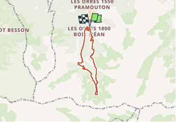

Length
11.2 km

Max alt
2238 m

Uphill gradient
592 m
Km-Effort
19.1 km

Min alt
1665 m

Downhill gradient
591 m
Boucle
Yes
Creation date :
2022-08-04 08:32:51.969
Updated on :
2022-08-04 13:49:41.1
3h31
Difficulty : Medium

FREE GPS app for hiking
 SityTrail
IGN / Geographical institutes
SityTrail Plus
The world is yours!
About
Trail Walking of 11.2 km to be discovered at Provence-Alpes-Côte d'Azur, Hautes-Alpes, Les Orres. This trail is proposed by cecileroy81.
Description
Début un peu monotone ou sinon très chouette
Positioning
Country:
France
Region :
Provence-Alpes-Côte d'Azur
Department/Province :
Hautes-Alpes
Municipality :
Les Orres
Location:
Unknown
Start:(Dec)
Start:(UTM)
305471 ; 4928733 (32T) N.
Comments